Information |
|---|
| Geography | |
| ?} |
 |
| History | |
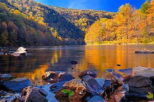
| ?} | The name of the Youghiogheny River is attributed to the Kanhawha Indians who had several villages around the river's highland waters. Youghiogheny translates to "four rapid streams," in reference to the junction of rivers in Confluence, PA. |
| Recreation | |
| ?} |
 |
Available as a Print or License to Use
Pictures by Michael D. McCumber |
|---|
|
|
Images |
|
|---|---|
Videos |
||||||
|---|---|---|---|---|---|---|
|
||||||
| Related Pages | |
|---|---|
| External Resources for "Youghiogheny River" | ||
|---|---|---|
| Web Search | Weather | News Search |